
New Cycling Trail connects Toronto and Caledon
posted by Joe on Tuesday, December 18, 2007 - Permalink
 The Mississauga News and Posted Toronto are both reporting that there are negotiations currently underway with the Greater Toronto Airports Authority to allow a cycling trail to use some unused land at Pearson International.
This would, according to the articles, connect the Etobicoke Creek Trail (which runs from Marie Curtis Park on the Mississauga-Toronto border to highway 401) to some existing and developing trails in Bramptom:
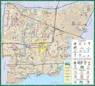
The finishing touches are being put on an agreement to allow a cycling trail to cross around the property of Pearson International Airport (PIA), providing a key link that could soon create a 50-km trail from Toronto to Caledon.The map at top is the City of Mississauga Cycling Map (click on it to link to the full PDF of the map) which shows a big fat NOTHING along the Etobicoke Creek - but the City of Brampton website has a good map of their section of this trail .
Negotiations have begun with the Greater Toronto Airports Authority (GTAA) and are expected to result in an agreement next spring to allow extension of the existing bike trail along the Etobicoke Creek Valley, says City of Mississauga Ward 5 councillor Eve Adams.
Adams, a member of the City's cycling advisory committee, told The National Post that, "the big push in cycling circles is this concept of connectivity. You want to be able to get onto a trail and go for a long run.”
Labels: infrastructure, news
The Mississauga maps actually shows a small section around Burnhamthorpe Rd along the Etobicoke Creek marked in purple. That trail actually connects to a new bridge over the creek into Toronto, and you can keep heading north along the creek or go up into Centennial Park.
That section of trail in Mississauga is a really nice paved trail. The Toronto side is unpaved / gravel though, IIRC. The further North you go, the rougher it gets.
A few photos from that area here...though I don't have any of the trail on the Mississauga side:
http://vic.gedris.org/pics/2007-11-02/
It would be awesome if this trail went further in both directions and connected more destinations together. It's sort of in the middle of nowhere though, so the actual destinations it services are pretty limited. But great for getting between parks and some of the residential 'hoods.
There are a couple of hydro corridors to the west (Mississauga) and east (Etobicoke) that would make awesome bikeways too.
I've been along the southern section of the trail through Brampton too. Pretty cool...though we got a bit lost once around Steeles Ave because it's not well marked.